High Island Reservoir East Dam is a place I’ve been wanting to go for quite some time but its quite a journey out to Sai Kung and then another journey out to High Island Reservoir East Dam itself. From Sai Kung you can take a Bus from Sai Kung Town part way to High Island Reservoir East Dam, getting of at Pak Tam Chung. It’s Bus No 94, you can find more details here. I just missed the bus and couldn’t be fucked waiting around 30 minutes for the next one so got a tax right to High Island Reservoir East Dam. It’s about 25 minutes and costs around $120 from memory (could be wrong there)

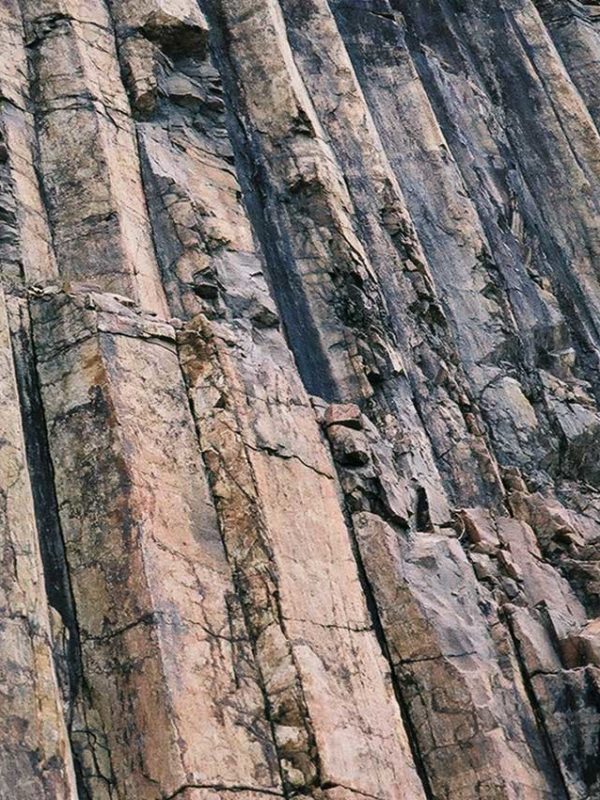
When you get to High Island Reservoir East Dam you can walk down and check out the GeoPark, there’s really not much to see here, some diagonal rocks, a cave you can’t get into and a walk along the sea with a giant boulder wall. Don’t be a dickhead and walk on there trying to get selfies, especially if you have kids.

I got on there but wasn’t that comfortable as one wrong move and you could fall down and cause yourself a bit of damage. Walking along the wall at High Island Reservoir East Dam you will reach a deaden that everybody seems to be going over to get to the cliff where you can see Po Pin Chau. This is where some guy fell and died, and I can easily see how that happened.

My original plan was to check out High Island Reservoir East Dam then run/hike over and up Sharp Peak. The weather wasn’t that hot but I spent almost an hour at the East Dam (maybe there was a bit to see) just walking around and taking photos. I decided instead to do the cliff thing overlooking Po Pin Chau so walked up from High Island Reservoir East Dam past the taxis, across the Wall or Actual Dam, on the left you will see a path.

This is bushwalking and I foolishly wore shorts not knowing about this. Anyway you hike up to the top, not far, about 5 minutes then back down towards Po Pin Chau. The paths are overgrown and your legs will get scratched to shit if you wear shorts like I did. The paths are also not that clear so you just take whichever one seems least overgrown. It’ll take you down towards Po Pin Chau then up a little bit to the top of the cliffs.

Honestly, I was shitting myself a bit. I mean a few wring steps and you’re off the cliff and dead. I saw a number of older people, like 70years +, but really, you’ve got to be careful here because the wrong move will spell disaster. There is no way in hell I would ever take my son up here. He could go to the High Island Reservoir East Dam but definitely not up on the cliffs towards Po Pin Chau, it’s just not worth the risk.

If you can take your child up there and have an accident, you deserve everything that’s coming to you. Anyway from there, I headed back towards the dam, if you look left there’s a trail up the mountain, take that and the bushwacking gets even worse. A trail is marked on Google maps but I must have somehow missed it and ended up on top the hill, which has magnificient views over the South China Sea and Sai Kung, but really, I was basically lost for a good 30 minutes.

The tracks are all overgrown and the only thing that was saving me was the ribbons from some trail run or hike. So basically I hiked for about 45-60 minutes until I eventually came out on the East Dam Road (Sai Kung Man Yee Road) or Machlehose Trail Section 1, about 500 meters from the Dam.

So basically I’d gone nowhere in about an hour. Coming down I had a group of spectators watching me, probably thinking I was some kind of Ultra hiker, when in fact I had no idea what I was doing and was glad to see people (and that is a rare occurrence!). They asked me where I came from as obviously not many people had done that route.

Anyway, from there I again foolishly decided to run back to Sai Kung, about 20km. Most of it is concrete but after the West Dam there’s a few tracks you can take, not really short cuts, but a little bit of shade. I thought about taking the bus or taxi once I reached tai Mong Tsai Road but my ego got the better of me and just ran the whole way back. Hard work but rewarding.

Stay tuned for the next hike around this area as I’ll be doing Sharp Peak over to East Dam, about 18km in a few weeks. Overall the High Island Reservoir East Dam area is nice, especially during weekdays when there are less people (still a lot of people in my books). It’s not an absolute must see but a nice day out.
Here’s some more photos to check out:


Send us any questions or comments you have about visiting High Island Reservoir East Dam via email or ask us on twitter.
High Island Reservoir East Dam